Most higher reaches of Kashmir received moderate to heavy snowfall, while the plains were lashed by rains, disrupting vehicular movement in some stretches, officials said on Monday.
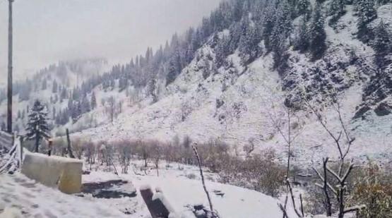
Several vehicles got stuck following heavy snowfall along the Sinthan Top following which police and army carried out a rescue operation on Sunday night to evacuate 214 stranded tourists and locals, they said.Officials said the tourist resorts of Gulmarg in north Kashmir’s Baramulla district, Doodhpathri in central Kashmir’s Budgam district, and Sonamarg in central Kashmir’s Ganderbal district, received moderate snowfall.
They said the higher reaches, including Pir Ki Gali along the Mughal Road in Shopian district of south Kashmir, Zojilla axis, Gurez in north Kashmir’s Bandipora, Sadhna Top in north Kashmir’s Kupwara, and Sinthan Top, connecting Anantnag in south Kashmir to Kishtwar in Jammu region, received heavy snowfall.
Sadhna Top has received over 12 inches of fresh snowfall, while Sinthan Top around six inches, they added.
The officials said the snowfall has led to the closure of the vital road links in the valley, including the Gurez-Bandipora road, Sinthan-Kishtwar road, and the Mughal Road, the alternate road connecting the Kashmir Valley with the Jammu region.
They said vehicular movement has also been suspended on the Srinagar-Leh highway due to accumulation of snow at Zojila Pass.
The plains of the valley, including Srinagar, were lashed by rains which continued intermittently till Monday morning.
Srinagar city recorded 15.9 mm of rainfall over the last 24 hours.
Pahalgam tourist resort, which also serves as one of the base camps for the annual Amarnath Yatra, received 15.7 mm of rains.
The wet weather has brought down the temperatures across the valley.
Srinagar city recorded the maximum temperature of 11.5 degrees Celsius on Sunday, which was nearly four degrees lower than normal, the officials said.
The other weather stations across the valley also registered below normal temperatures.
The lower temperatures broke the trend of unusually higher day temperatures prevalent in the valley over the last few weeks.
The Meteorological Department has forecast erratic weather till March 20.
It said there is a possibility of a brief spell of light rain or snow in the higher reaches, at isolated places on Monday and Tuesday.
From March 18-20, the weather will remain generally cloudy with a possibility of intermittent light to moderate rain or snow at many places.
The MeT Office said another wet spells is likely on March 24-25, with light rain, or snow in the higher reaches, at scattered places.
It said there is a possibility of thunder or gusty winds, about 40-50 kmph, at a few places on Monday, and March 18-20.
The weather office has advised farmers to suspend farm operations till March 20.